Arctic Cold Grips Cumberland County Before Rapid Midweek Warm-Up
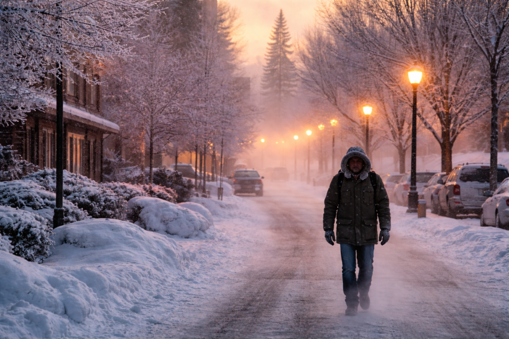
Cumberland County began Monday under an Arctic air mass that kept temperatures locked in the single digits despite mostly sunny skies. The National Weather Service maintained a cold weather advisory through 10 a.m. Monday, warning that wind chills would fall to 10 degrees below zero across the Philadelphia region.
Sunshine offered clear visibility and brighter conditions, but it did little to reduce the danger posed by the bitter wind. The combination of frigid air and persistent gusts made outdoor exposure hazardous for anyone spending extended time outside.
Across the Delaware Valley, a cold weather advisory remained in effect until 10 a.m. Monday with wind chills down to 10 below zero, according to CBS News Philadelphia. In the Poconos, conditions were even harsher, where an extreme cold warning continued through the same time with wind chills reaching 20 below zero.
Monday’s daytime temperature was forecast to reach only 29 degrees before dropping overnight to 7 degrees. Meteorologists warned that these conditions could lead to frostbite on exposed skin within minutes, prompting local officials to urge residents to limit outdoor activity and dress in multiple layers when necessary.
While the region endured another dangerous day, forecasters projected a rapid change beginning Tuesday.
Temperatures were expected to rise above freezing each afternoon for the rest of the week, climbing into the mid and upper 30s with some locations possibly reaching the low 40s. Overnight lows were also forecast to moderate, falling into the teens Tuesday morning before settling in the 20s and 30s through the remainder of the week.
Tuesday and Wednesday were expected to reach the upper 30s, and in some areas, the low 40s. Daytime warmth would allow snow and ice to melt, but refreezing overnight would create slick conditions during early morning hours, particularly for commuters.
A very weak weather system was projected to pass north of Philadelphia Tuesday night, bringing a small chance of a few sprinkles or a wintry mix north of the city into the overnight hours. Aside from that brief possibility, conditions were expected to remain dry through Saturday.
The alternating pattern of daytime melting and nighttime freezing created ongoing risks for pedestrians and drivers. Meltwater could refreeze into black ice, especially on untreated roads, sidewalks, and shaded surfaces.
By Valentine’s Day on Saturday, temperatures were forecast to remain above freezing but still chilly, with highs in the mid to upper 30s under partly cloudy skies.
Forecasters were monitoring a potential storm system late in the weekend into early the following week. Some weather models showed a larger system bringing rain and snow to the region, while others suggested weaker development. Meteorologists said they would continue tracking trends, with attention focused on Sunday into Monday.
The seven-day forecast outlined a steady warming pattern after Monday’s cold:
- Tuesday: Cloudy, high of 40, low of 18
- Wednesday: Partly sunny, high of 40, low of 33
- Thursday: Partly sunny, high of 36, low of 30
- Friday: Partly cloudy, high of 37, low of 23
- Saturday: Partly cloudy, high of 38, low of 20
- Sunday: Possible precipitation, high of 36
Emergency management officials kept warming centers open for residents without adequate heat as conditions remained hazardous. Even as temperatures rose midweek, officials cautioned that changing road conditions would continue to pose risks during morning commutes due to repeated freeze-thaw cycles.