Snow… or No?
Are you ready for wintry weather? Snow before Thanksgiving? Read our annual winter weather forecast.
Ahhhhh! Can you feel my excitement? This is literally my favorite forecast to do all year. I spend a couple weeks researching before actually putting anything down on paper. I guess it’s my favorite because growing up it was always those big snowstorms that I loved most. In Brigantine, it was either feast or famine. We were often afflicted by the rain/snow line but every now and then, like in 1996 and 2003, we ended up with tons of the white stuff. I’m still a fan of snow and I enjoy forecasting it because oftentimes snow predictions are the most challenging forecasts of the year.
I understand not everyone reading this shares my enthusiasm for snow. I get it—and I don’t let my love of winter skew my professional opinion. I look at the facts and create a forecast objectively—not to suit what I want to happen.
I’ve been doing this for a decade and out of 10 winter forecasts, five were dead on, three were very close and two were absolutely horrible. My worst forecasts were my first and last year’s. Last year, everything looked huge leading up to winter and then never materialized.
 What went wrong? I relied too heavily on the impacts of the Madden-Julian Oscillation (all the details are on my website: noreasternick.com/blog/2019-2020-winter-outlook-cold-stormy-or-warm-dry) and overlooked all the warm water in the western Pacific Ocean. We got creamed with that Pacific flow, which destroyed any hopes of sustainable cold. And when the cold did come, it was too cold to snow. A high pressure system set up to our north was so strong that it pushed a couple storms to our south over the Carolinas and we got nothing.
For that reason I urge everyone to take these long-range projections with a grain of salt. Simply put, we are good at getting the next five days right… beyond that there are still wide variances. We are closing that gap, but not as fast as I’d like.
With that said, here are my projections for winter 2019/20, starting with my temperature outlook.
The core of the cold should be centered over the Great Lakes and decrease the farther south you go. For New Jersey specifically, I think it’s a battleground. I’m going with average temps. That doesn’t mean we won’t get a couple really good cold snaps, but I don’t see it being sustainable. We will get our traditional warmups now and again. I think it’s a wash more or less.
With ridging of the jet stream out west, I’m expecting the warmest weather relative to average in places like California, Nevada and Arizona. On the opposite side, Florida looks a tad warmer than normal.
November looks cold. We should moderate for December. The coldest month I believe is January with swings in February and March.
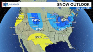
PRECIPITATION OUTLOOK: With the active jet stream, I fully believe most of the wet (or white) weather will be from eastern Montana to Delmarva. I like the idea of many precipitation events—rain, snow and mixed stuff. We will probably end the season four or more inches above normal. The dry weather will be through Texas the west coast.
 STORM TRACKS: We can achieve these numbers several ways. It depends on what type of pattern is overhead at a specific time. The different types of storms are clippers, Miller B storms and Miller A storms.
Clippers are quick-moving storms that drop one to four inches across an area… in and out. They dive down from Alberta Canada and move through the Ohio Valley into the Mid Atlantic. I think we will see six to eight clipper events between December and late February.
Miller B storms are the bane of most forecasters’ existence. They are very tricky to forecast and you either have feast or famine when it comes to snow. They start out as clippers but then transfer their energy to a coastal low that can intensify and bring intense wind/rain/snow to the Mid-Atlantic and Northeast. These move a little slower as it takes some time for the transfer of energy to happen. I’ve seen some big busts with these. One comes to mind, I believe it was actually 2014. We were projecting 30 inches of snow for some and we ended up with a dusting! It happens. It also can go the other way. There was a storm, some call Jonas, that was a bad storm, a Miller B. It caused flooding worse than Sandy for some!
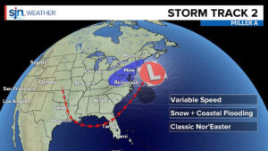
Miller A storms, for any weather weenie, are the storms you want to track. These are the classic nor’easters that form with moisture from the Gulf. Their speed is variable, as is their impact because it’s solely based on track. If they go over an area off of Delmarva called the “benchmark,” we can end up with very sizable snow totals. These are the storms that can also bring massive flooding. It’s all about the timing. Bring one in during a new or full moon and it’s a bad situation all around. These often “bomb” out… they undergo bombogenesis as they move up the coast. Simply put, they get really strong, really fast. Many of you may remember the ‘62 Nor’Easter. It was worse than any hurricane in recent memory for South Jersey.
As I stated at the beginning of this article, long-range forecasting isn’t the most accurate but we can get a decent handle on how things will likely play out based on what we’ve outlined. Never believe specific storm forecasts you see on social media two weeks out. They’re absurd. Many times forecast models jump to the most extreme situation and then back way off within just a couple cycles. Know who to trust. There are many reputable forecasters out there. Find them!
A lot of people look at winter and judge it on snow alone. If you live at the coast, tidal flooding is a bigger concern. Keep in mind that a major blizzard could bring 20 inches of snow to the mainland but only a couple inches at the coast—but the flooding could be major. That’s what needs to be looked at when prepping from an Emergency Management standpoint.
I don’t think this is going to be an extreme winter, but I do think it will be more active than last year and it will snow more than last year. The “bust factor” is there… if the southeast ridge wins out (as it has in the past) you can throw everything out the window. We will know as it’s happening.
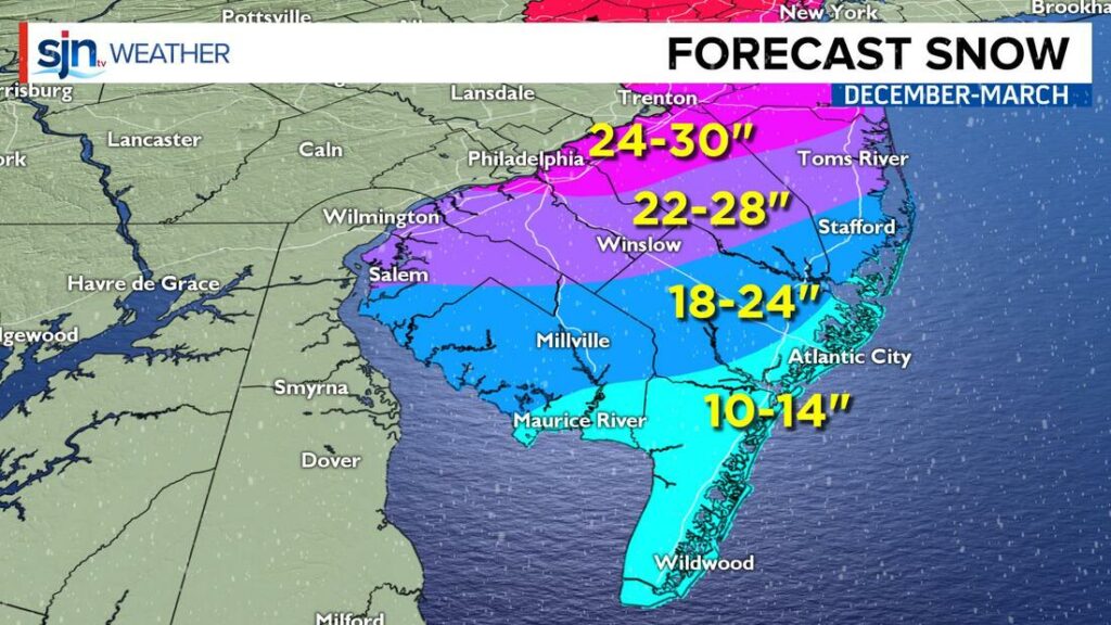
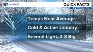
In summary, November will be below average. Our first snowfall could be sometime around Thanksgiving! We will likely warm up a bit in December before the core of the cold gets here in January. We will also be looking at an active January and February. Several light two- to four-inch events with two to three five-inch plus events.

