On the Trail
Long in length, long in the making, the New Jersey Long Trail is now nearing completion.


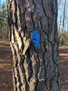
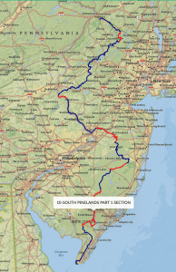
There is exciting news for those of you who love to discover new places to wander and explore. A 383-mile hiking trail is being developed from High Point (New Jersey’s peak elevation) to Cape May Point (at sea level). This trail, which is highly representative of New Jersey’s natural environment, has been in the making for a number of years and is now nearing completion. Varying in width from four to seven feet, and marked with marlin-blue blazes, the path follows existing trails and dirt/sand roads across rolling hills, upland wooded areas, waterways, farms, pineland forests, cranberry bogs, historic communities, and even passes our State Capitol at Trenton. This “greenway path” also uses former railroad corridors, utility lines, canals, and existing parks and wildlife management areas. In the north it follows sections of the Appalachian Trail and in the south it picks up our beloved Batona Trail.
The exciting news for us, as Citizens United Maurice River members and all nature enthusiasts in this part of the state, is that the NewJersey State Long Trail crosses into the Estell Manor County Park, then into the expansive Peaslee Wildlife Management Area, and enters Belleplain State Forest at Weatherby Road. The trail continues into the heart of Belleplain by going around Lake Nummy and on to Woodbine, connecting with the bike path and eventually on to Cape May!
Important: This trail is not yet completed! It passes through both public and private lands making access challenging in some locations. However, 293 miles of the 383 miles are either marked or clearly accessible to the public. And there are long stretches that can be walked on public lands. Volunteers are currently blazing the path, building bridges, and working (in some cases) on purchasing key sections of access. By February, the marlin-blue blazes through Belleplain State Forest should be completed.
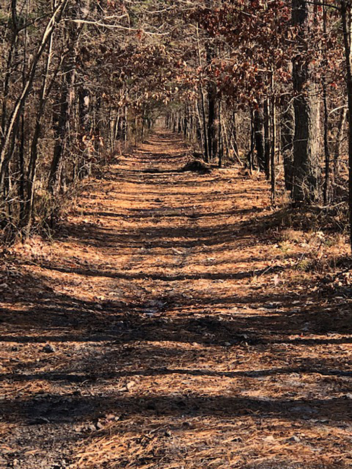
 Sections of the trails, like Belleplain, are remote and often unvisited. They follow old sand roads that go into the forest. The magical cedar swamps, large swaths of blueberries, the endless upland oak/pitch pine stands, and tea-colored cedar streams/ponds are all there to discover. Be forewarned: It is very wet in some sections with numerous puddles that need to be skirted. Nonetheless, it is exciting to have access to these beautiful, natural areas in our own backyard. See you on the trail! n
About the author: Educator Peter Manzelmann is a CU Maurice River member. A seasonal employee at Belleplain State Forest and Corson’s Inlet State Park, he is one of the many volunteers helping with this project. He has met with the Long Trail creators and is volunteering his time this winter to blaze the sections that weave through Belleplain’s forest. The Forest has also recently received a two-year federal grant to restore, maintain, and properly mark Belleplain’s 24 hiking and multi-use trails. Peter is enjoying this volunteer work and has been assigned to deal with the Belleplain federal trail grant.
To learn more about the NJ State Long Trail visit the New Jersey Sierra Club website for a detailed narrative and distances for specific sections. Note that the “Southern Pinelands Trail Sections – Part One and Two” highlight the areas discussed in this article. For specific questions related to the Belleplain section of the trail contact Peter Manzelmann at [email protected].


