Two weeks ago I focused on winter exploration and some of the benefits of exploring in southern New Jersey, especially in the snow with a youngster or two. This article is devoted to picking a trail and offers some suggested places to stroll in cold weather.
Locations with mixed habitat types offer the best viewing opportunities for wildlife and for exploring different kinds of vegetation. Since we live on a coastal plain with lots of waterways and forests, there are many places for habitats to interface and overlap. These areas are called ecotones, where two biological communities meet and integrate. The size of these interfaces can be narrow or wide. In some places they can be localized, while in others they may encompass an entire region.
Along the New Jersey Delaware Bayshore we have vast wetlands ribboned by large forested buffers, some of them uninterrupted for miles. For example, connected preserved lands from the Maurice to the Cohansey rivers span about 17 miles of bayfront. The collective acreage along the bay exceeds 15,000 acres and, if you move inland, Bevan Wildlife Management Area alone is an additional 40,000 acres. (In this article, I will not include a discussion of the land to the southeast of the Maurice, which stretches to the Villas along the Bay.)
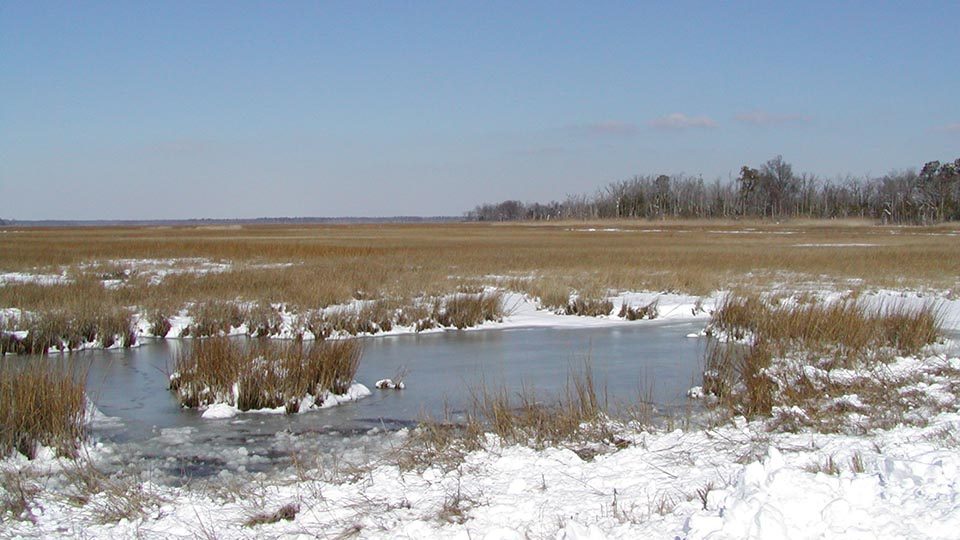
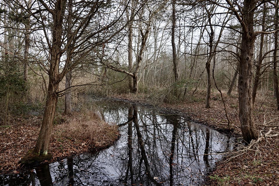
Envision this 17-mile stretch of bayfront with a ribbon of wetlands about two miles wide, and then the forested community or farmland that abuts it. The forest is often hardwood swamp before it rises to upland—a blend of forest and upland woods. There are areas of open water, either tidal pools or former mining operations. In some stretches there are sandy beaches. This is the mosaic that defines the southern New Jersey Delaware Bayshore.
Again, where each of these ribbons and patches of habitat meet is an ecotone. These areas are often more populated by species than either of the two habitats that they bridge. It is the integrated community of animals and their shared use that causes a greater richness and abundance of species. When protecting lands, many biologists/researchers argue that these ecotone areas are biodiversity-rich centers and therefore deserve the greatest investment in conservation.
Our state’s wildlife managers have divided the state into six landscape regions for the purpose of sustaining wildlife populations. The area extending from Cape May to Salem that borders the Delaware Bay is not surprisingly called—the Delaware Bay Landscape Region.
This regional approach gives a special framework for management efforts based on rivers, watershed boundaries, ridgelines, soils, vegetation, and the like. The state’s landscape project—prepared by the New Jersey Department of Environmental Protection, Division of Fish and Wildlife, Endangered and Nongame Species Program—in its 3.3 plan, described the Delaware Bay Landscape region as follows:
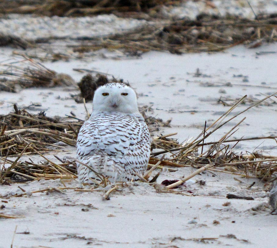
“This landscape encompasses all or parts of Cape May, Atlantic and Cumberland counties. It features significant populations of bald eagle, barred owl, eastern tiger salamander, Cope’s gray treefrog and 30 other endangered and threatened species. The vast woodland tracts of this region are among the largest in the state and support a large portion of New Jersey’s neotropical birds and interior-forest bird populations. The extensive saltwater marsh and sandy overwash beaches support a significant horseshoe crab breeding area and shorebird migrations of worldwide ecological significance, including that of the red knot. Despite significant losses of habitat, the Cape May Peninsula remains one of the country’s most important migratory ‘stopovers’ for hundreds of bird and insect species. The expansive habitat mosaic of rivers and streams flowing into the tidal Delaware Bay supports concentrations of rare wildlife and wintering waterfowl.”
Each region is evaluated based on habitat, types, quality and species usage in an effort to be proactive in the protection of species located within its boundaries. Our Delaware Bay Landscape Region is remarkable in that it supports a greater number of endangered species than any other region in the state.
Here in southern New Jersey we are afforded many great wildlife viewing opportunities. Because a great deal of space is protected and publicly owned we have a great deal of recreational access to do just that.
Knowing this, I suggest you seek out the vast areas of connected space, or a patch surrounded by urbanization that has ecotones and therefore acts as a biological sink or magnet for activity. By way of example, Millville’s Maurice River Bicycling and Walking Trail concentrates activity along the waterfront. The trail offers riverine, tidal wetlands, hardwood swamp, and upland forest. In addition, it is paved and much of it is wheelchair accessible. Because it is surrounded by homes it acts as an oasis for wildlife that is funneled into this space for lack of other options in the surrounding area.
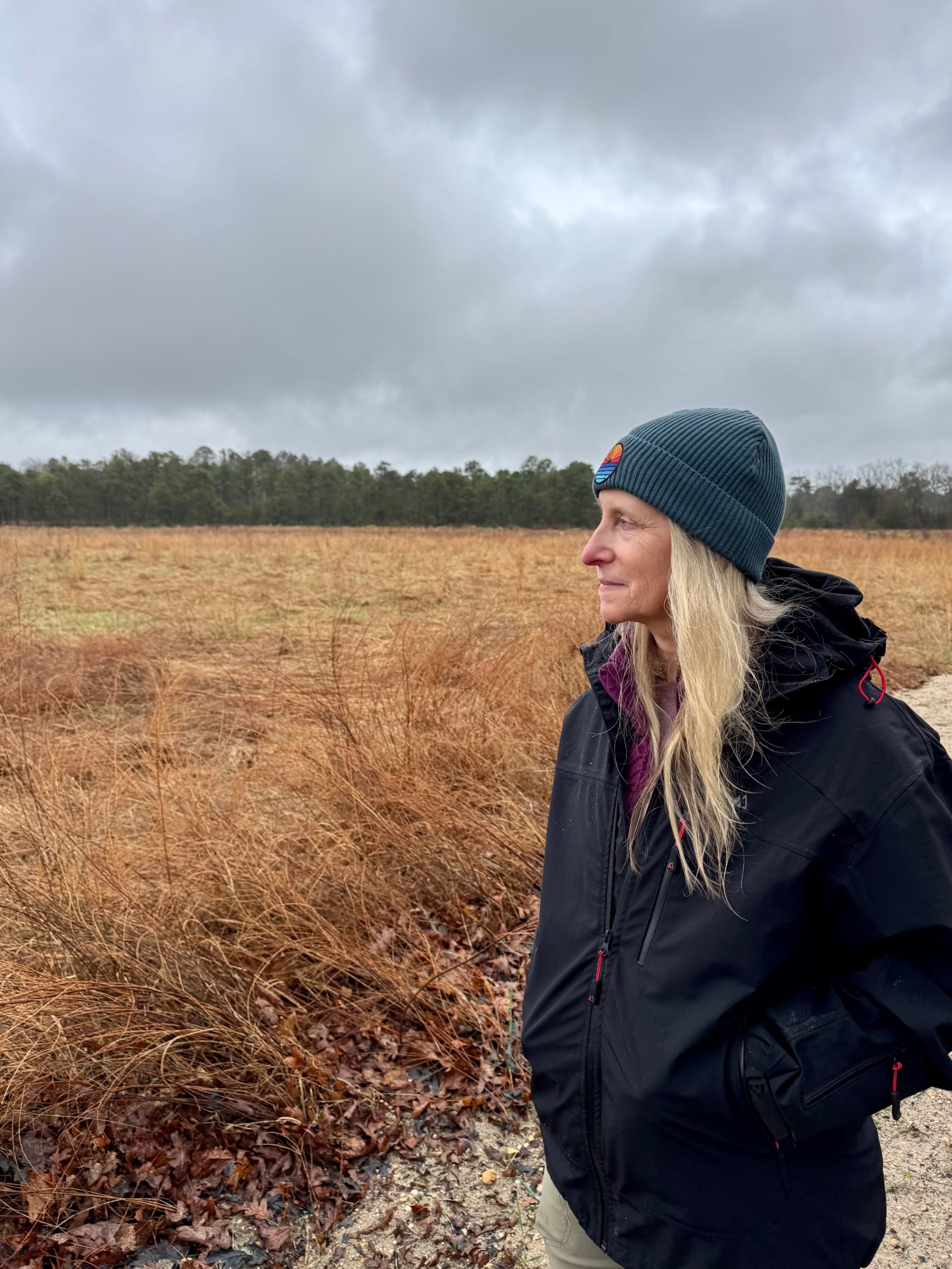
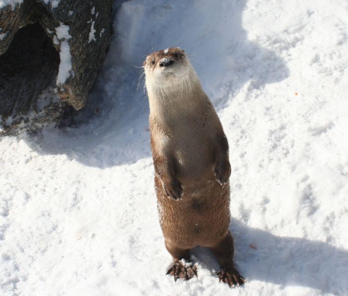
In winter I like to choose natural areas that have some forest as part of the mix in order to break windchill. For instance, if you view for a time the marsh or open water areas for ducks, birds of prey, and possibly a mink or otter, you can re-enter the woods to warm up and look for songbirds.
The following trails are level and offer little challenge with the exception of water. One has limited wheelchair accessibility. All fall within the 17-mile stretch of Bayshore as defined in the article except for Millville. This is far from a complete list but is a good starting point.
https://dep.nj.gov/wp-content/uploads/njfw/lp_report_3_3.pdf
Suggested Hikes at New Jersey Wildlife Management Area
It is customary to drive to the end of Turkey Point Road to enjoy the viewing platform and the bridge crossing Johnson’s Ditch. This is the Egg Island Point New Jersey Wildlife Management Area. There is a very short 0.2-mile dike walk on the other side of the bridge. This is a super spot to watch for waterfowl and raptors, especially eagles and northern harriers.
A favorite hike for many local birdwatchers is Hansey Creek Rd., Downe Township. Most of the trail is bordered by Egg Island Wildlife Management Area. If you begin your walk at the confluence of Russell Lane and continue to the end it is about three miles, one way. There is a parking area and boat launch at the end from which you can walk from marsh to woods, until you’ve accomplished a distance with which you are comfortable. The road gets little traffic but you need to be mindful of vehicles anyway. Most folks travel from the Russell Lane end so the woods opens up into the marsh. There are tidal ponds and then large ditches at the end that are part of a kayak trail. Winter kayaking here is only for very experienced paddlers.
The Lake Audrey Wildlife Management Area in Commercial Township is a half mile west of the Maurice River Causeway Bridge on Route 649. This is an inactive mining pond that has been restored for fishing, and for this purpose the water has been limed. It offers some nice views and treks.
Natural Lands Trust Trails
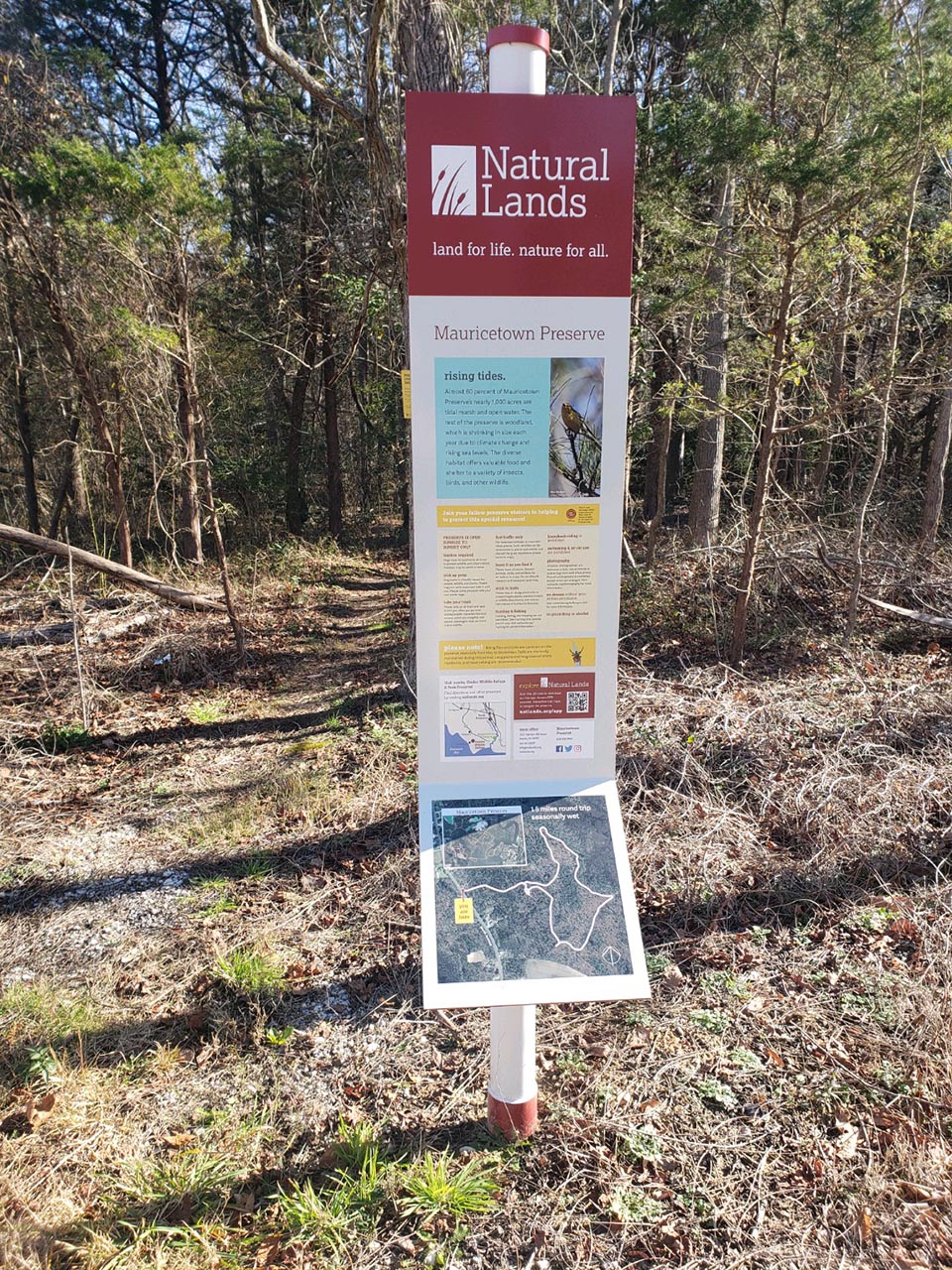
Mauricetown Preserve Trail – Commercial Township. Off North Avenue on east side of road before Port Norris. 1.5 mile loop blazed white trail. Trail sign for orientation. Northern edge of trail borders the marsh but there are not marsh views. The woods offers a respite from winter winds.
These next three trails are accessible off Maple Avenue/Turkey Point Road in Dividing Creek, Downe Township. Given in order of occurrence: beginning at Rt. 553 turn on to Maple Avenue where you will cross impoundments. Be sure to scan for winter waterfowl. All are a part of the Glade’s 7,000+-acre complex of preserves. Boots are recommended in all instances, especially on Eagle Trail.
After crossing the impoundments turn left on to Franklin Lane. Go to the gate of the Garrison Property Preserve – This relatively recently purchased preserve offers little cover from the wind but more fields than the other three trails. During eagle breeding season you can walk about ¾ of a mile in and out.
Return to Maple Ave. Make a right and in two-tenths of a mile the entrance to the Maple Ave. Trail is on the left. There is a trail head sign and it is clearly marked. It offers lots of ditched streams and plenty of cover from the winds. There are a few marsh views. It is well marked. This is a 1.5 mile trail with a loop at the end. The loop is sometimes over grown and you can simply double back.
Continue on Maple Avenue; it will turn into Turkey Point Road (do not turn right – go straight). On the right will be the Eagle Trail’s trailhead, also marked with signage. This trail floods on high tide events and sometimes during regular high tides. Boots are necessary. This trail is also a 1.5-mile trail with a loop at the end. (See Egg Island suggestion under Wildlife Management Areas.)
If you return to 553 (Main Street) via Turkey Point Road and travel westward, turn on Methodist Road (Rt. 732) Newport, turn left onto Newport Landing Road, and then a left on to Fortescue Road. (Rt. 637). Two-tenths of a mile after Cabin Road there is a gate on the left, which is the trailhead for the Tat Star Trail. The 1.6-mile path crosses woods and ends at the large marsh complex of Oranoaken Creek.
After enjoying Tat Star, a drive to the waterfront in Fortescue is a must. The beach is accessible on New Jersey Avnue. at either end of the waterfront homes. Raybin’s Beach is at the south end and there is a public access beach by Fortescue Creek at the north end. Parking is available at each end of the island as well.
Hikes at PSEG Restoration Site Properties in Commercial Township
PSEG has restored what were once bayfront diked salt hay farms to tidal flow, and all have public access.
In Port Norris across from the Bayshore Center on Bivalve’s High Street there is a short spur called Germantown Ave. At the end you can park and explore the eastern side of the 4,100 acre Commercial Township Restoration Site. The Site has two more access points, one of which comes off Strawberry Avenue on the south side of Route 553. It is possible to walk from one access point to the other and southward for a two-mile trek in each direction. There is little to no cover from the wind but great views of the marsh. Optics will be necessary to see avian denizens. The Georgetown Avenue entrance offers handicapped access for outdoor wheelchairs.
A mile further east on Route 553, Robinstown Road heads south to the marsh. At the end of the road you can access another Commercial Township PSEG restoration site. You can choose to walk the dike or duck into the woods on two or three spurs. There are nice vernal pools at this location and in the spring it is a favorite place to listen for calling frogs.
Travel Route 553 into Fairfield Township and turn left on Back Neck Road to take in views of the 1,000-acre Cohansey Restoration site. There is a marked viewing area on the north side of the road.
Afterward a trip from Schoolhouse Road to Seabreeze Road is in order. Seabreeze is a ghost town on the Bayfront.
Many of these areas are on AllTrails.com. The Natural Lands also manages a phone application. Do not rely on the application on site in case cell connection is sketchy. I recommend taking phone snapshots for easier access on the hike, in case you lose connectivity.